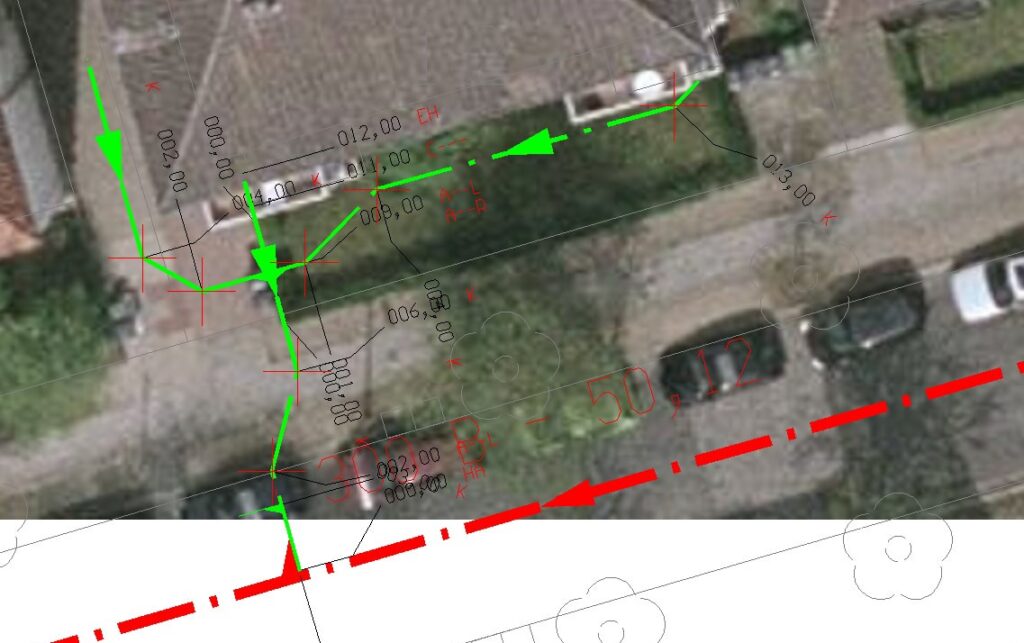
Do you know where all the sewer pipes and gas lines are on your property? It is safe to say that most home and business owners don’t, and no one wants excessive digging done in their yard to find these pipes. Thankfully, there are devices available that can be used help locate sewer pipes and ducts underground. At R&R Visual Inc. we are trained to use detection devices and can help quickly locate leaks and broken pipes. Underground sewer locating is a technique that plumbers use in drain cleaning, plumbing installation and sewer repairs. This is done by electronically detect underground lines using detector machines. The detectors usually have inductive signal transmission system that indicates the presence of an underground line on the LCD display. From there, our operators can effectively pinpoint the location of sewer lines, water lines and other pipes throughout your property. This aids in safe digging, leak detection and sewer repairs.
Map Data Generated from Sonde Locator
R&R Visual's Sondes Include:
Super, bendi, standard sewer, super small, and conduit sondes
Depths from 1’ to 49’
Types of pipe cast iron, steel, plastic, wood, vitrified clay, and many others
Lateral location for new construction, point repairs, mapping, and digging
Major defect association above ground
Underground sewer line, drain line, and water line location and routing
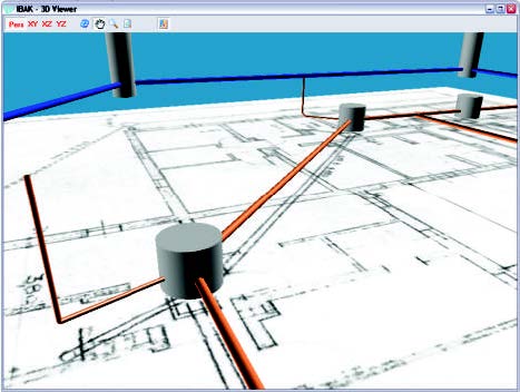
3D GeoSense - Mapping of pipelines in X Y Z
R&R Visual offers mapping of pipeline of all diameters using 3D GeoSense. As the camera moves through the pipeline, the three dimensional coordinates are streamed to our mapping software. The data can be integrated to your GIS data or used by other applications.
Real-Time Positional Data Acquired Quickly and Easily...
This revolutionary system gives our technicians the power to map mainline and lateral pipelines with accuracy and speed. The 3-D GeoSense sensor tracks the movement of the camera as it travels through the lateral, capturing distance, position and depth in three dimensional space. This data is captured and displayed by your data logging software. Finally, there is no more guessing. You no longer have to track the system above ground with a locator, simply conduct your inspection and collect the positional data.
This is the perfect system for crossbore inspection analysis!